
Open Geospatial Consortium (OGC) Teams with GISMO for the Development of the Model for Underground Data Definition and Integration (MUDDI)
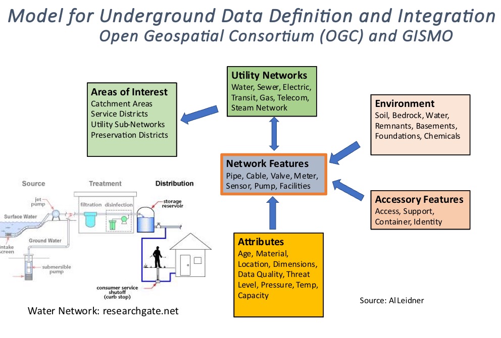
The MUDDI model is intended to serve as a basis for integrating underground data from multiple sources, systems, and schemas.