
by Noreen Whysel
Since well before 9/11, GISMO, the NYC region’s oldest GIS interest group, has been working on advocacy initiatives to improve the way New York City collects, stores, shares and manages Geospatial Data and the processes and strategies around the City’s Geographic Information Systems (GIS) and related functions. Beginning in 1996, the City’s first GIS Director, GISMO member Alan Leidner, held this role until his retirement from civic service in 2004. During his tenure, Leidner oversaw NYC’s emergency mapping program in one of the country’s most complicated rescue and recovery operations, the September 11, 2001 attack on the World Trade Center.
Just two years prior to 9/11, the City had launched a common base map for all agencies to use in GIS applications. Prior to the 1999 base map, there was little coordination between agencies on the underlying coordinates of various features on maps. As a result, data such as street center lines (which were available from the US Census though not always accurate) and building footprints would not match up with the level of accuracy needed for an effective response in an emergency situation. As City agencies created their own maps and datasets, using proprietary systems and software whose license agreements precluded data sharing, it was becoming increasingly difficult to form a common operating picture. This created difficulties for routine maintenance projects like coordinating access, excavation and repair of street corners and threatened larger operations. After the World Trade Center attacks, when visible landmarks were no longer available, the new base map saved time, money and lives.
But things have changed since 2004. When Leidner retired, a new GIS Director was appointed, but he was not given the same level of responsibility and did not get the assistant commissioner title the post had carried previously. Laws providing the public open access to a multitude of agency datasets created a market for public information and tools created taking advantage of them. Mayor Bloomberg wrote an executive order that created the Mayor’s Office of Data Analytics, but the mandate did not cover the kind of sensitive data that would be required to handle multi-department programs and, crucially, emergencies. As a result response to events like Hurricane Sandy was fractured, affecting the ability of emergency services, DEP, MTA, ConEd and other entities to coordinate their activities.
GISMO recently published Guiding Principles and Policies for New York City’s Geospatial Architecture outlining its position on the role of geospatial technology and governance in NYC government. It presented the Principals and Policies work at a public forum at Hunter College in April 2018. GISMO further pursued its position that NYC must have a GIS Director and coordinating committee made up of GIS leads at all city agencies and is recommending a Charter amendment or legislation to make this happen.
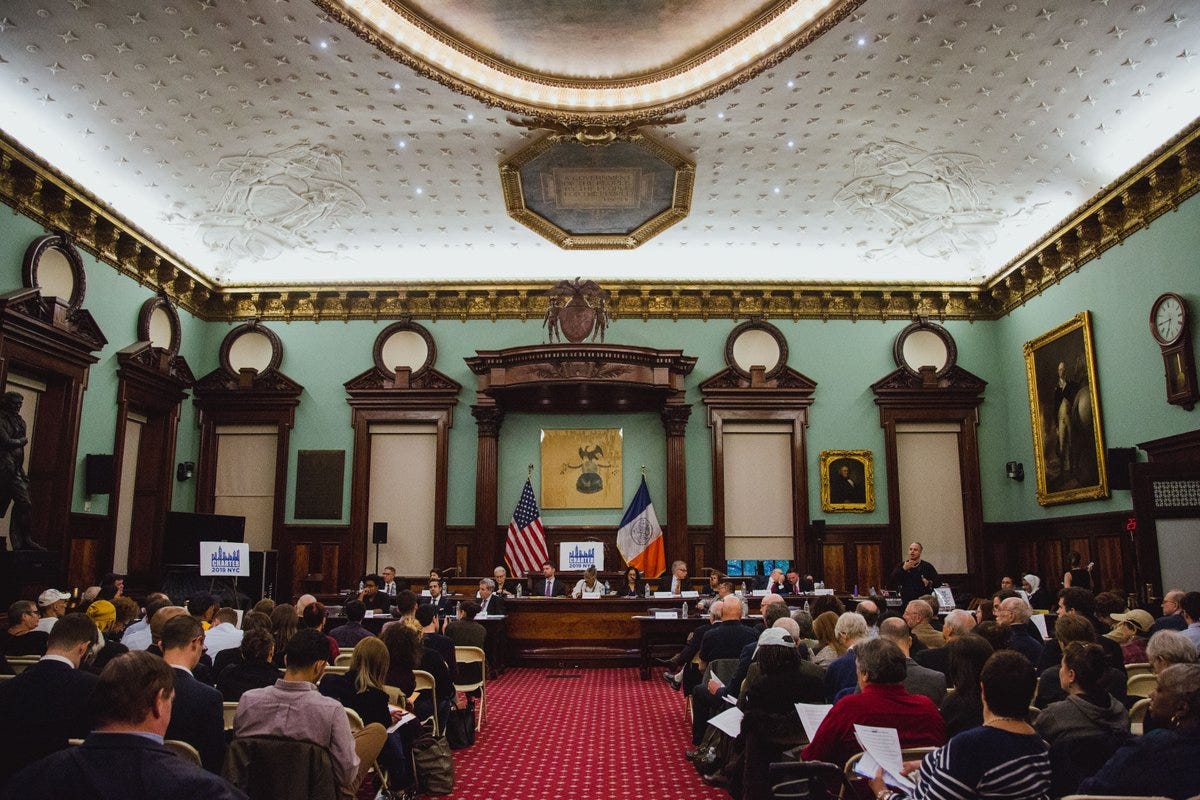
GISMO posted its introductory statement, video and written testimonies regarding the proposed amendments to the New York City Charter which is available at http://www.gismonyc.org/events/amend_nyc_charter/. These testimonies were delivered to the New York City Council Charter Committee on April 30, May 2, May 7 and May 9, where several GISMO members, including myself, testified at the public hearings.
Through this Charter initiative we have advanced the cause of GIS in NYC by bringing our demands for better governance into the public forum. GIS saves lives, protects infrastructure, supports planning, improves City services, increases tax collections, and enhances economic development. We estimate that GIS at least doubles the analytic powers of traditional IT. We call on City government to recognize these facts and act accordingly.
You can find my testimony (gismonyc.org) and video (YouTube), starting at 02:25:15 but to get the full context, it’s best to review the statements in order. To explore how lives are saved by faster 911 response visit NYS GIS Association’s GISCalc tool created by Decision Fish, Results that Matter Team, and funded by the Fund for the City of New York.
If you are interested in learning more about GIS governance in New York City, contact GISMO at info@gismonyc.org or contact your New York City Council representative.